| Picture comment | | Picture (thumbnail) |
Picture 06-4-115
Galdhöpiggen far away. |   | 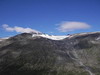 |
Picture 06-4-116
This is the way to walk. | | 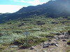 |
Picture 06-4-117
view of Visdalen. | | 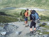 |
Picture 06-4-118
Steep uphill. | | 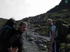 |
Picture 06-4-119
and after that the route leveled out. Glittertind far away. | | 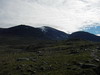 |
Picture 06-4-120
Aslo some reindeers enjoyed the terrain. | | 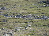 |
Picture 06-4-121
A short break at the route cross towards Glittertind/Glitterheim | | 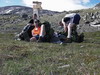 |
Picture 06-4-122
Flat terrain with some stones. | |  |
Picture 06-4-123
Skautflye. | | 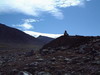 |
Picture 06-4-124
If you missed the sign you got another chance. | | 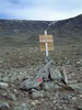 |
Picture 06-4-125
Still rather flat with path to follow. | | 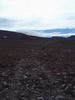 |
Picture 06-4-126
A glance back towards Galdhöpiggen. | | 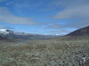 |
Picture 06-4-127
Veobreen on the other side. | | 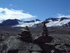 |
Picture 06-4-128
Vesegluptjönen. | | 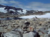 |
Picture 06-4-129
A lot of stones. | | 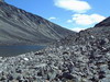 |
Picture 06-4-130
Stoney. No tent places here... | | 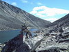 |
Picture 06-4-131
The view towards Veo. Soon the path went downwards. | | 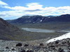 |
Picture 06-4-132
Where we came from. Loose stoned made the walk difficult. | | 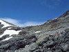 |
Picture 06-4-133
But soon the path leveled out and the walk was easier. | | 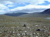 |
Picture 06-4-134
Veobreen again. | | 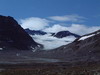 |
Picture 06-4-135
The first view of Glitterheim. | | 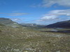 |
Picture 06-4-136
Not many meters left. | | 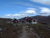 |
Picture 06-4-137
Somewere above Hansson and Annika are on their way down. | | 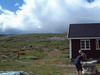 |
Picture 06-4-138
Here they are! | |  |
Picture 06-4-139
View towards Spiterstulen. | | 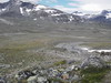 |
Picture 06-4-140
The worse stone landscape in front of us. | | 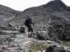 |
Picture 06-4-141
Finnaly some uphill slopes. | |  |
Picture 06-4-142
You almost had to climb. | |  |
Picture 06-4-143
Nice color variations. | | 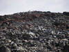 |
Picture 06-4-144
Glittertind far away. | | 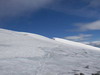 |
Picture 06-4-145
People on their way up. | | 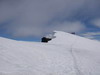 |
Picture 06-4-146
Soon we are there. | | 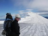 |
Picture 06-4-147
Little snow made the path icey and slippery. | | 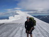 |
Picture 06-4-148
A satisfied Annika at the peak. | | 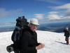 |
Picture 06-4-149
Hikers from Glitterheim on their way up. | | 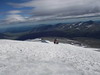 |
Picture 06-4-150
Nice peaks around Galdhöpiggen. | | 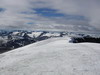 |
Picture 06-4-151
Berra is walking somwhere below. | | 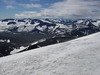 |
Picture 06-4-152
Steinbuvatnet. | | 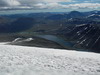 |
Picture 06-4-153
Nice views from the peak. | | 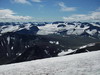 |
Picture 06-4-154
A peak picture. | | 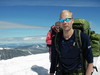 |
Picture 06-4-155
Some more steps and you stand on the overhang. | | 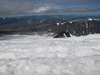 |
Picture 06-4-156
Time to move again. | | 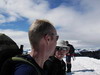 |
Picture 06-4-157
Finally downhill again. | | 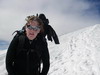 |
Picture 06-4-158
Just follow the path. | | 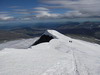 |
Picture 06-4-159
Here you see the overhang quite well. | | 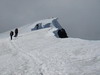 |
Picture 06-4-160
A lot of people on their way. | | 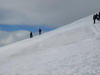 |
Picture 06-4-161
Finally some stones again. | | 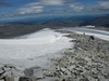 |
Picture 06-4-162
A nice peak. | | 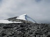 |
Picture 06-4-163
A last picture before Glittertind dissappears. | | 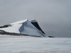 |
Picture 06-4-164
Downhill towards Glitterheim. A lot of stones. | | 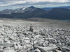 |
Picture 06-4-165
Glittertind started to fade away. | | 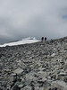 |
Picture 06-4-166
Finally some green terrain again. | | 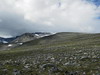 |
Picture 06-4-167
Veodalen. | | 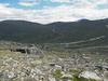 |
Picture 06-4-168
Glitterheim. | | 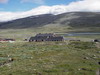 |
Picture 06-4-169
The sign outside the hut. | | 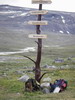 |
Picture 06-4-170
A dog waiting for departure. | | 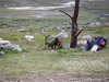 |
Picture 06-4-171
An old stone cottage. Of course with the Norwegian flag outside. | | 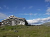 |
Picture 06-4-172
A short nap before the dinner. | | 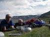 |
Picture 06-4-173
Relaxing on the bench. | | 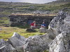 |
Picture 06-4-174
A beer is never wrong. | | 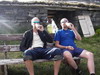 |