| Picture comment | | Picture (thumbnail) |
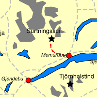
Picture 99-7-73
Lot of campers (scouts?) at Memurubu. |   | 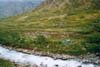 |
Picture 99-7-74
Nice path = happy faces. | | 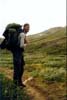 |
Picture 99-7-75
Still easy terrain. | | 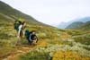 |
Picture 99-7-76
This is how it goes if you can’t stay on your feet, Bert! | |  |
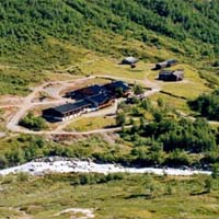
Picture 99-8-77
The best camp so far not far from Surtningssubekken. | | 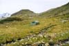 |
Picture 99-8-78
The route towards Surtningssui. | | 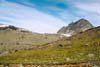 |
Picture 99-8-79
Vestre Memurubreen. | | 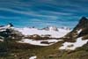 |
Picture 99-8-80
Bert is checking the glacier at the side of the valley. | | 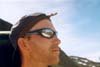 |
Picture 99-8-81
The route cross below Surtningssui. We left our backpacks and continued towards the top. | | 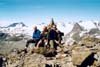 |
Picture 99-8-82
The stone cottage that we passed on our way towards the top. | | 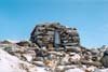 |
Picture 99-8-83
We are getting closer. | | 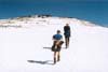 |
Picture 99-8-84
Icy stones at the steep. | | 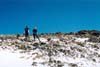 |
Picture 99-8-85
The view from the top 2368 meters above sea level in north direction. | | 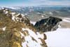 |
Picture 99-8-86
Nautgardstind at the upper left corner. | | 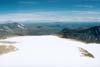 |
Picture 99-8-87
Besshø. | | 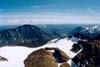 |
Picture 99-8-88
Glittertind far away. | | 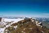 |
Picture 99-8-89
The view towards Gjendealps. | | 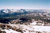 |
Picture 99-8-90
Memurutindane between the glaciers. | | 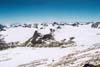 |
Picture 99-8-91
Picture from the top of Surtningssui. | | 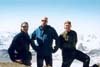 |
Picture 99-8-92
The south east peak, 2302 meters above sea level. | | 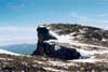 |
Picture 99-8-93
Surtningssui. | | 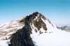 |
Picture 99-8-94
Knutshø in the background. | | 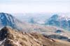 |
Picture 99-8-95
Sometimes the peaks aren’t far from each other. | | 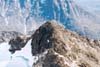 |
Picture 99-8-96
Scary steep, almost vertical a couple of hundred meters. | | 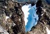 |
Picture 99-8-97
The glacier south of Surtningssui. | | 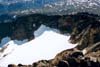 |
Picture 99-8-98
Sometimes it’s more than stoney. | | 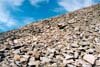 |
Picture 99-8-99
The east route back to Memurubu. | | 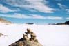 |
Picture 99-8-100
It was a little bit steeper than we thought. | | 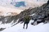 |
Picture 99-8-101
The outflow of the creek at Memurubu. We took the shortest way down. | | 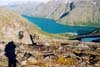 |