| Picture comment | | Picture (thumbnail) |
Picture 00-4-30
6 kilometer and 27 chicanes to get to Öygardstölen in half an hour. You just wanna throw up.... |  | 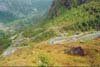 |
Picture 00-4-31
Öygardstölen is rather nice situated on the edge of the cliff. | | 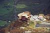 |
Picture 00-4-32
The harbour of Lysebotn. | | 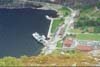 |
Picture 00-4-33
Three Germans that we walked with towards Kjeragbolt. | | 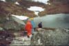 |
Picture 00-4-34
Snow was still left on the mountain. | | 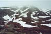 |
Picture 00-4-35
The Germans are far behind. | | 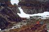 |
Picture 00-4-36
Berra in the fog. | | 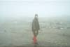 |
Picture 00-4-37
When the sky was cleared from clouds you got a nice picture of the landscape. This photo was taken just beside the path cross Kjerag/Langavatnet. | | 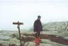 |
Picture 00-4-38
The first picture of Kjeragbolt. Would you dare jumping from the cliff edge up to the stone? | | 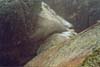 |
Picture 00-4-39
Tough weather with snow and ice. | | 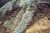 |
Picture 00-4-40
From here you can take very nice pictures when the sun shines. | | 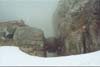 |
Picture 00-4-41
From the crack to the bottom of the valley it is incredible 1000 meters. | | 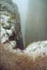 |
Picture 00-4-42
The stone is situated well were it lays. | | 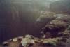 |
Picture 00-4-43
A break with chocolate and bilberry soup. | | 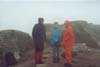 |
Picture 00-4-44
Snow and fog. We just like it! | | 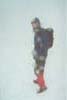 |
Picture 00-4-45
The weather was quite better when came downhill. | | 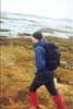 |
Picture 00-4-46
A lot of expectant hikers on the way up. | | 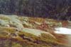 |
Picture 00-4-47
A school class on the path. | | 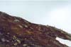 |
Picture 00-4-48
The rescue helicopter was looking for some missing hiker. | |  |