| Picture comment | | Picture (thumbnail) |
Picture 01b-2-27
Falketind from far. |   | 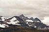 |
Picture 01b-2-28
The lodge in Koldedalen. | | 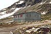 |
Picture 01b-2-29
The valley towards the lakes. | | 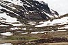 |
Picture 01b-2-30
Magnus is fixing his boots. | | 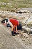 |
Picture 01b-2-31
Stony as usual. Koldedalsvatnet in the background. | | 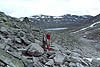 |
Picture 01b-2-32
The first lake. | | 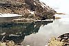 |
Picture 01b-2-33
To the right you have the snow hill we were forced to pass. | | 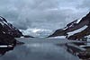 |
Picture 01b-2-34
But it seemed to be difficult because the path had fallen down into the lake. | | 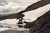 |
Picture 01b-2-35
We saw foot steps in the snow just by the lake but we choosed another way. | | 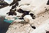 |
Picture 01b-2-36
We followed the snow edge and then rounded it. | | 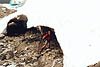 |
Picture 01b-2-37
Because we didn't want to stumble down into the water. It looked very cold... | | 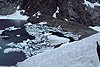 |
Picture 01b-2-38
Magnus follows the snow edge upwards. | | 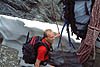 |
Picture 01b-2-39
Andre vatnet (the second lake). | | 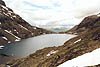 |
Picture 01b-2-40
The steep hill towards the glacier. We walked on the right side of the brook and had to use our arms to get up. | | 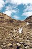 |
Picture 01b-2-41
The glacier on the opposite side of the second lake, Andre vatnet. | | 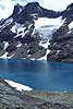 |
Picture 01b-2-42
We are finally standing at the glacier, Stölsnosbreen. | | 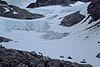 |
Picture 01b-2-43
Hansson is ready for another hard walk at the glacier. | | 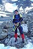 |
Picture 01b-2-44
Falketind in sunshine. | | 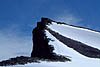 |
Picture 01b-2-45
We left our equipment at the foot of Falketind and continued the hard hill. | | 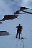 |
Picture 01b-2-46
Some climbing among the rocks. | | 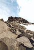 |
Picture 01b-2-47
The steep downto Falkbreen. | | 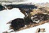 |
Picture 01b-2-48
Yes! We can't get any higher. A beer was splited and we noticed that someone had brought more expensive liquids uphere. | | 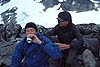 |
Picture 01b-2-49
Koldedals vatnet and our tent place in the middle. | | 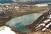 |
Picture 01b-2-50
Uranostind. | | 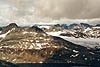 |
Picture 01b-2-51
Uranostind with the lake Urdadalsvatnet. | | 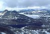 |
Picture 01b-2-52
A compulsory group picture at the top. | | 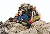 |
Picture 01b-2-53
Another one. | | 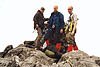 |
Picture 01b-2-54
Someone had a party here...We found three champagne corks! | | 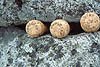 |
Picture 01b-2-55
Stölsnosbreen and Stölsnostinden in the background. | | 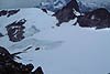 |
Picture 01b-2-56
Another picture at the steep. | | 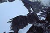 |
Picture 01b-2-57
Time to go home. Hansson is ready. | | 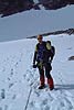 |
Picture 01b-2-58
And also Berra and Magnus are ready. | | 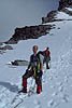 |
Picture 01b-2-59
Utladalen far away. | | 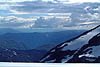 |
Picture 01b-2-60
We choosed to round the craks. No shortcuts! | | 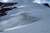 |
Picture 01b-2-61
Back on compact ground again. | | 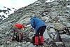 |
Picture 01b-2-62
Berras back pack is packed and ready. Observe the water bottle which is good to have on glacier hikes. | | 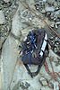 |
Picture 01b-2-63
It was steep down to Andre vatnet (the second lake). | | 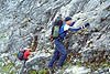 |
Picture 01b-2-64
Hansson is looking for a good track. | | 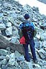 |
Picture 01b-2-65
The same snowhill as before. We took the same way. | | 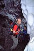 |
Picture 01b-2-66
If you have path signs like this one, it's easy to navigate. | | 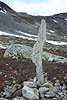 |
Picture 01b-2-67
Back at the base camp. The light worked well. | |  |
Picture 01b-2-68
Another picture of Falketind. | | 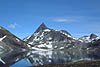 |